Escrick History
Ice Age to Saxon times
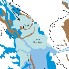
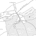
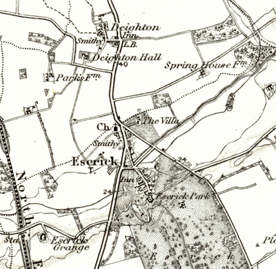
The moraine ridge (which runs roughly along the present Cawood Road, and through what is now Queen Margaret's school towards Wheldrake) would have provided an area of dry land above the more waterlogged lands of the Vale of York. The ridge was also a key route between the River Ouse at Riccall (the limit of navigation at the time from the North Sea) and York and Stamford Bridge.
1086
~ 1100
1252
1323
1539
Then demised by the Crown to Thomas Knyvett in 1597
1668
When the estate was acquired it was described as: Manor of Escrick with capital messuage, messuages, cottages, windmill and lands (Lord's Carre,Riccall Hagge, Bloome Croft and West Garth, Fogge Carre; Hither, Middle and Further Hall Flatts; Calfe Close, Horse Close, Buskett Close, Lund Wood, Horse Pasture, Hilly Flatt, the Ings, the Intake,Ricall Parke, Dighton Spring)
Manors of Escricke and Bardolgarth with 20 messuages [later corrected to 60],10 tofts, 1 windmill, 1dovecote, 40 gardens, 1500ac. land, 200ac. meadow, 1000ac. pasture, 400ac. wood, 1000ac. heathand furze .
The Escrick Estate has remained in the ownership of descendents of Sir Henry Thompson to the present day.
1683
1680-1700
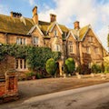
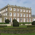
Although modified and extended since, the current hall dates from this time.
1770s
1776
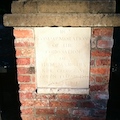
The stone remains on the bridge to this day - BT referring to Beilby Thompson
late 1770s
This started a period of reshaping the village, and establishing the hall with its own grounds with some separation from the rest of the village. The village was effectively relocated north of its former location - with the former site of the village becoming the grounds of Escrick Hall.
1781
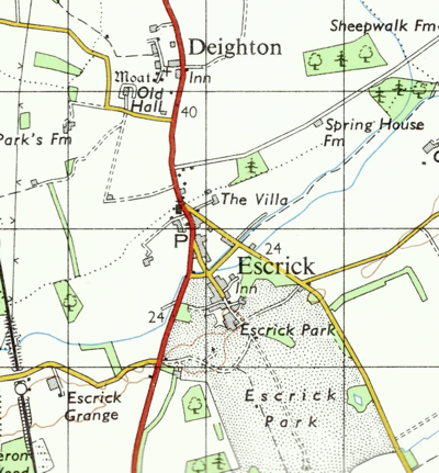
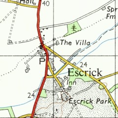
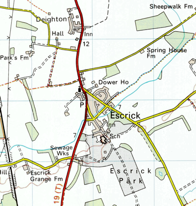
The new road followed a line to the west of Main St, along in part what is now the footpath leading to the playground. This was diverted further west in the 1820s, roughly along the present course of the A19, and at the same time Skipwith Road was established providing a bypass to the east.
1783
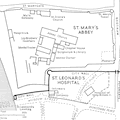
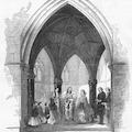
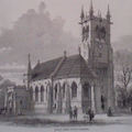
Remains of the old church (located to the west of the then Escrick Hall), are thought to have remained until ~ 1920.
1801
1820
Paul Beilby Lawley (1784-1852) inherited the Estate in 1820 and changed his name to Thompson. He became Baron Wenlock in 1839 and was granted a licence to put the name Lawley before that of Thompson and for his heirs to take the name Lawley only.
~1825
By 1844 there were 142 pupils on the roll.
1831
A rapid increase in the population during the first quarter of the nineteenth century, took the population to a peak of 717 - a level not reached again until the early 1970s.
1830s
The remains of this decoy can still be seen in Gashouse woods and to the east of Skipwith Road. A second decoy was built a few years later further south on Skipwith Road.
1841
1846
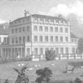
The hall now standing in its own extensive grounds, with no fewer than three drives approaching it, each guarded by a lodge house.
1848
The rectory was replaced with a newer smaller building in 1951, with the 1848 rectory becoming part of Queen Margaret's School for a time, and then later the Parsonage Hotel.
1840s
More recently converted to flats of the same name.
1856-7
1857-8
(Now Derwent Court)
1861
1860s
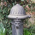
Water was drawn from an artesian well located just north of the hall. One of the four original hydrants can still be seen on Main St, opposite the footpath leading to the primary school.
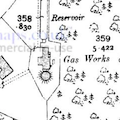
Gas works were constructed in the area that now forms Gashouse woods behind Carrs Meadow.
1871
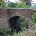
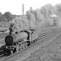
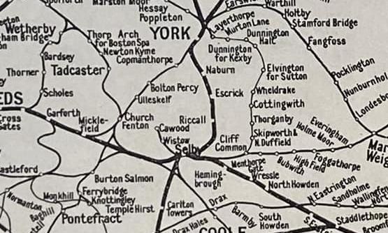
Located about 1 mile west of the village on the road leading towards Stillingfleet, adjacent to what is now Lilac Cottage. There was once an extensive rail network south of York, with Escrick council and Lord Wenlock being instrumental in the construction of the Derwent Valley line, which ran through Skipwith.
1871
1897
1897
1901
The size of the village had shrunk during the Victorian era, with industrial towns providing employment, and farming suffering from cheaper overseas imports. Towards the end of the Victorian era, landlords such as the Wenlocks increasingly invested in their villages in an attempt to encourage residents to remain.

1904
1908
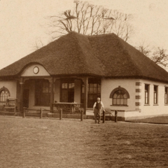
(originally known as Escrick Institute)
1911
1915-1919
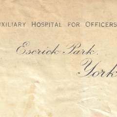
1917-1919
1920
1920
Presumably the arrival of electricity to the village made the need for gas for gas lamps redundant?
1921
1923
It was rebuilt two years later. In the interim, an old army hut was acquired from Catterick. After the church was restored, the hut was used as a Village Hall, until it's replacement in 1975.
1929
1932
It was destroyed by fire in June 1942, and replaced with the current pavillion in 1968.
1937
1939-45
The village housed many evacuees from Northern cities. Hollicarrs Woods was used as a munitions store from 1942 - with the remains of several of the brick and concrete buildings still visible.
1949
The school additionally occupied a number of buildings in Escrick, including the now Parsonage and Dower House, before consolidating on the current site at Escrick Hall.
1951
1953
The railway itself remained (part of the East Coast Mainline from Edinburgh to London) until 1983 when it was re-routed further west due to expected subsidence from mining.
1961
1960s
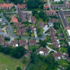
This period of development more than doubled the population of the village - the increased ownership of motor cars started the era of Escrick as a commuter village.
1971
1970s
1972
1973
(Until 2007 the primary school was split across two sites, with the juniors on the new site, and seniors in the Old School House).
1974-75
Replacing the ex-army hut which was previously used
1979
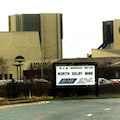
Residents of Escrick fought against the proposed mine complex. Sinking of the 1km deep shafts for the mine commenced in 1979 and completed in 1986. Production started in January 1991 and continued until the merger with Stilingfleet mine in July 1997. The site was used for several years after as a training location.
Unlike neighbouring mines, the mine deliberately did not use the Escrick name.
Coal was not extracted at this location - instead being carried by conveyor belt to Gascoigne Wood.
1980s
During the 1980s changes in the nature of farming began to impact the nature of the Escrick Estate. Small farm holdings began to be amalgamated into larger units, and the Estate began to convert the now redundant farmsteads into office and industrial units. At the height of this rural diversification development, the Estate provided some 41 business units.
1985
1991
1991
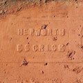
A brickworks had existed on the site (west of the current Escrick Business Park) since approximately 1850, with its own quarry on-site. The brickworks closed in 1991 and the factory building was demolished in 2006.
1990s
1996
The bells were replaced by the former bells from St Martin-in-the-bullring (Birmingham). These bells were hung in a new two-tier 10 ton galvanized steel frame set on a massive re-inforced concrete gillage. The new frame contained 14 pits, to allow for latter augmentation. The more mellow tone of the new bells proved extremely popular in a village which had fallen out of favour with the previous ones.
1996
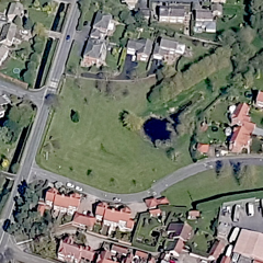
The Village Green was established as part of the Carrs Meadow development, having previously been farmland. The Green is leased to the Parish Council by the Estate on a long-term peppercorn rent.
2001
The 2001 Census reports 857 residents in 359 households, plus a further 378 residents in communal living
2004
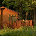
As a further diversification the Estate started the development of "The Hollicarrs" - a woodland holiday park which now comprises of nearly 170 timer lodges and chalets in the Hollicarrs woods south of the village.
2005
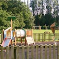
A group of parents coordinated fund raising through a mix of grants and local fund raising to invest in a new playground on land kindly made available by the Estate on a peppercorn rent.
2007
The former school site is redeveloped for housing.
2008
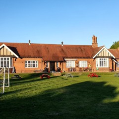
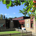
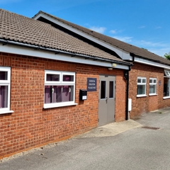
The Village Hall received a £144,204 Lottery grant in 2008 which was used to extend and refurbish the village hall, provide an extra meeting room, modernise the kitchen, improve disabled access and toilet facilities and increase storage space.
2011
The 2011 Census reports 909 residents in 370 households, plus a further 169 residents in communal living

2014
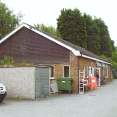
A buyer could not be found to take over the village store.
2016
2021
The 2021 Census reports 933 residents in 385 households, plus a further 130 residents in communal living.

2021
A year later the premises are sold and an application to convert to three residential properties is approved. The pub dates from the 1750-1770, and was known as The Spotted Bull in 1823, later 'The Bull' and then laterly The Black Bull, with the current facade built 1865-1866.
2022
A planning application for eight houses is submitted, preserving some of the historic slaughterhouse buildings.
2023
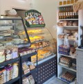
Tenacious work by a small group of residents results in a new village store opening, 9 years after the previous general store closed. Unfortunately the store closed at the end of the year.

2025
124 years since it was founded, and 76 years after it moved to Escrick, Queen Margaret's School closes and enters administration, due to financial pressures.
At the time of its closure, it had around 215 pupils of which about 80% were boarders. It employed around 150 people and was believed to be Escrick's largest employer.